Southern Alberta Photo Tours
Southern Alberta Mountain Foothills & Prairie heritae Circle tour
Start/End: Lethbridge
Total Distance: ~290 km
Drive Time: Approx. 3.5–4 hours (plus stops)
📍 Route & Photo Highlights
Lethbridge → Magrath (32 km)
-
LDS pioneer settlement town
-
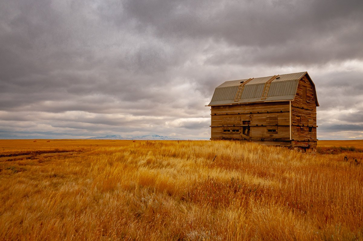
Historic grain elevators and prairie farmland scenes
Magrath → Cardston (25 km)
-
Cardston Alberta Temple (historic LDS architecture)
-
Remington Carriage Museum (largest collection of horse-drawn vehicles in North America)
-
Classic small-town prairie streetscapes
Cardston → Mountain View (18 km)
-
Rolling ranchlands and Rocky Mountain foothills views
-
Big sky and open-range cattle country
Mountain View → Waterton Lakes National Park (26 km)
-
Prince of Wales Hotel overlooking Upper Waterton Lake
-
Red Rock Canyon, Cameron Falls, and iconic wildlife viewing
-
Photogenic mountain, lake, and townsite shots
Waterton → Twin Butte (20 km)
-
Rustic Twin Butte General Store & Café
-
Perfect for lunch stop, quirky signage, and foothills scenery
Twin Butte → Pincher Creek (39 km)
-
Wind farms and ranchlands with mountain backdrops
-
Kootenai Brown Pioneer Village for heritage pioneer photography
Pincher Creek → Fort Macleod (50 km)
-
Fort Museum of the North West Mounted Police — historic fort site, heritage buildings, and NWMP Musical Ride reenactments in summer
-
Historic Main Street, early 1900s buildings, Empress Theatre
Fort Macleod → Lethbridge (52 km)
-
Wide open prairie views on the return stretch
-
Optional sunset shoot at Lethbridge High Level Bridge (Canada’s longest and highest trestle bridge)
📸 Perfect For:
-
Full-day photography tours
-
Landscape, history, and cultural documentation
-
Wildlife, pioneer towns, historic landmarks, and foothills ranch country

Hoodoos, Wildlife and Water
Distance: ~160 km
Drive Time: Approx. 3.5-4 hours total driving (plus stops)
Route:
Lethbridge → Writing-On-Stone Provincial Park → Milk River → Manyberries → Shaughnessy → Lethbridge
Highlights & Photo Ops:
-
Writing-On-Stone: Hoodoos, Indigenous rock art, Milk River views.
-
Milk River: Small town charm, riverside scenes.
-
Manyberries: Quiet prairie landscapes, wind turbines, rural life.
-
Shaughnessy: Historic grain elevators, farmland views.
Ideal For:
Geology enthusiasts, Indigenous culture, wildlife, river and landscape photography.

Badlands to the Foothills
Distance: ~180 km
Drive Time: Approx. 4 hours total driving (plus stops)
Route:
Lethbridge → Waterton Lakes National Park (entrance) → Cardston → Magrath → Raymond → Lethbridge
Highlights & Photo Ops:
-
Waterton Lakes: Mountain vistas, lake reflections, wildlife, hiking trails.
-
Cardston: Historic LDS temples, cultural sites.
-
Magrath & Raymond: Small towns, rodeo history, local events.
-
Badlands areas around Raymond for unique geology.
Ideal For:
Mountain landscapes, cultural sites, rodeo or local events, diverse terrain photography.
Heritage & Prairie Charm
Distance: ~220 km
Drive Time: Approx. 4-5 hours total driving (plus stops)
Route:
Lethbridge → Stirling → Wrentham → Skiff → Foremost → Etzikom Windmill Museum → Bow Island → Taber → Coaldale → Lethbridge
Highlights & Photo Ops:
-
Stirling Agricultural Village: Historic buildings, quaint streets, heritage architecture.
-
Wrentham & Skiff: Iconic grain elevators, abandoned townscapes, prairie vistas.
-
Foremost: Small town charm and fossil heritage (optional quick stop).
-
Etzikom Windmill Museum: Windmills, pioneer village, open prairie skies.
-
Bow Island & Taber: Charming town scenes, local produce stands, sweeping fields.
-
Coaldale: Vibrant small-town life, gardens, and murals.
Ideal For:
Heritage lovers, prairie landscapes, architectural details, rural life photography.